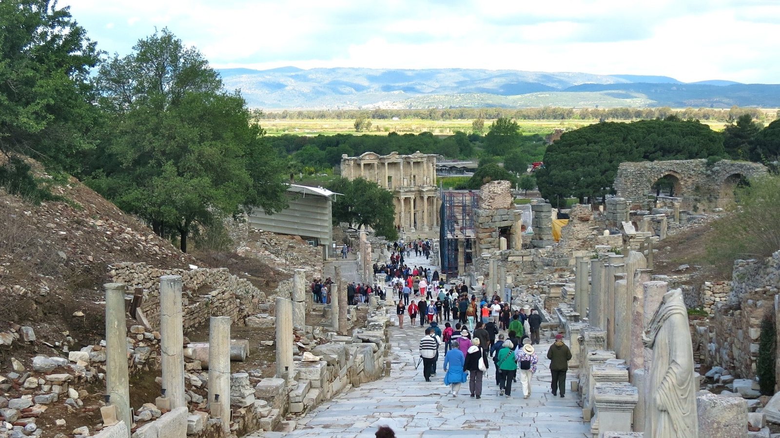
Stand at the top of Curetes Street and the shape of Ephesus is plain to see: a marble street running downhill through a valley, with a hill on each side. Almost everything you visit was built between these two hills or cut into their slopes, so knowing which is which makes the whole site easier to read. Here is where each hill is, what it holds, and what the confusing names mean.
Add The Ephesus as a preferred source on Google
What are the two hills of Ephesus?
The two hills of Ephesus are Mount Pion (Panayırdağ), the lower hill on the north side of the ruins, and Mount Koressos (Bülbüldağ, or Mount Nightingale), the higher ridge on the south side. The Hellenistic and Roman city filled the valley between them, and its walls climbed both slopes.
The Austrian Archaeological Institute, which has excavated here since 1895, describes the ancient city in exactly these terms: its center stretches between Bülbüldağ in the south and Panayırdağ in the north. When King Lysimachus refounded Ephesus around 300 BC, he laid out the new city in this valley and ran a wall of eight to nine kilometers along both hills; our post on who built Ephesus tells that story.
| Mount Pion | Mount Koressos | |
|---|---|---|
| Turkish name | Panayırdağ (“fair mountain”) | Bülbüldağ (“nightingale mountain”) |
| Side of the ruins | North and east | South |
| Height | About 150 m | A ridge over 350 m |
| What it holds | Great Theater, Stadium, Cave of the Seven Sleepers | Terrace Houses, Hellenistic walls, House of the Virgin Mary |
| Can you visit it? | Its foot, on every visit | Its slope inside the site; Mary’s House by road |
Mount Pion in Ephesus: the hill of the theater
Mount Pion is the rounded, lower hill, about 150 meters high according to NASA’s satellite elevation data, and the lower city wraps around its western and northern foot. Its Turkish name, Panayırdağ, means “fair mountain”. You see it best from Marble Street below the Library of Celsus: the green hill rising behind the theater.
- The Great Theater. The Roman builders set the seating of the Great Theater of Ephesus straight into the western slope of Mount Pion, so the hill carries the weight of the upper rows. It is the single best view of the hill on any visit.
- The Stadium. North of the theater, the Stadium of Ephesus lies along the foot of the hill, its long track laid out against the slope.
- The Cave of the Seven Sleepers. On the eastern side, rock-cut tombs and a church mark the Cave of the Seven Sleepers, where the legend of seven young Christians walled up in a cave was set.
- The oldest shrines. At the northern foot of the hill lay an open-air sanctuary of the mother goddess, with niches and reliefs carved into the rock; the UNESCO evaluation of Ephesus names this cult of Meter on Panayırdağ among the city’s oldest. The Sacred Way of Artemis also circled the hill.


Mount Koressos, or Mount Nightingale: the higher ridge
Mount Koressos is the long, higher ridge on the south side of the ruins, and its Turkish name, Bülbüldağ, means “nightingale mountain”, which is why English speakers call it Mount Nightingale. Above the ruins it rises to more than 350 meters, and it climbs on to the south into pine and olive woods. Curetes Street follows its foot.
- The Terrace Houses. The wealthy built their homes on the north slope of Bülbüldağ, stepping up the hill above Curetes Street. Today the Terrace Houses of Ephesus sit under a modern roof, with their wall paintings and mosaics still in place.
- The Hellenistic walls. Stretches of Lysimachus’s wall still run along the crest of the ridge above the ruins. From the State Agora, look up at the ridge to pick out a line of squared stone high on the hill.
- The tower called St Paul’s Prison. At the western end, where the ridge reaches toward the old harbor, a square tower of the same Hellenistic wall is known locally as St Paul’s Prison. No evidence links it to the apostle; it is a city defense tower that later picked up the name.
- The Grotto of St Paul. A painted cave chapel on the slope above the city, the Grotto of St Paul, is closed to visitors for conservation, with no reopening date announced.

Where is Mount Nightingale and the House of the Virgin Mary?
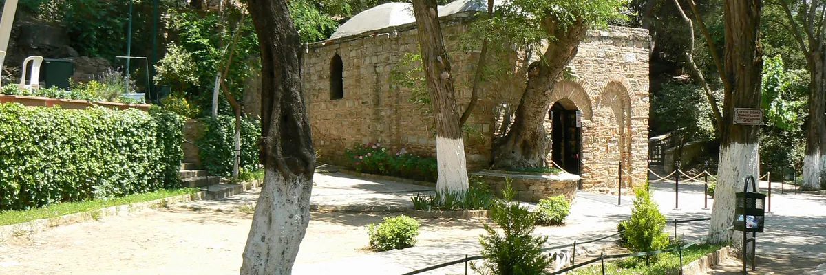
Mount Nightingale is right beside the ruins of Ephesus, near Selçuk in İzmir Province, Türkiye: it is the ridge you see on your left as you walk down Curetes Street. The House of the Virgin Mary stands high on it, about 420 meters above sea level among olive, pine and plane trees, roughly 7 km by road from the ancient city.
The road leaves the Upper Gate and climbs the ridge in bends, past the golden Virgin Mary statue, to a small stone chapel where tradition holds that Mary spent her last years in the care of the apostle John. Turks call it Meryem Ana Evi, and the hilltop around it is Panaya Kapulu. UNESCO counts the House of the Virgin Mary as one of the four parts of the Ephesus World Heritage property. Most visitors reach it by car or tour vehicle; there is no regular footpath up from the ruins.

Pion, Koressos, Preon: why the names get mixed up
Ancient writers named several hills and districts around Ephesus, and scholars still debate exactly which modern hill each name belonged to. The convention used on most maps and in most guidebooks, and on this site, is Mount Pion for Panayırdağ and Mount Koressos for Bülbüldağ. But you will meet other versions: some archaeologists call Bülbüldağ Preon or Lepre Akte, and a few Turkish studies swap Pion and Koressos altogether.
The Turkish names are the safe ones. Panayırdağ is the theater hill to the north, Bülbüldağ is the Terrace Houses and Mary’s House ridge to the south, and every local guide, driver and sign uses them. Our map of Ephesus marks both, and our history of Ephesus explains how the city moved between them.
Seeing both hills on a visit
Most visits start at the Upper Gate, in the saddle where the two hills almost meet, and walk downhill along the valley, with Bülbüldağ on your left and Panayırdağ ahead and to the right. The Ephesus city tour route never climbs either summit: you walk their lower slopes, and the views do the rest. The best spots for each hill:
- For Mount Koressos: the State Agora near the Upper Gate, looking up at the ridge and its wall, and Curetes Street, where the Terrace Houses climb the slope.
- For Mount Pion: the square in front of the Library of Celsus and Marble Street, looking at the theater cut into the hill.
- For the whole valley: the top of Curetes Street, looking down toward the Library and the plain where the harbor once was.
To add Mount Nightingale’s summit, you need a vehicle for the drive up to Mary’s House. Our Ephesus and House of Virgin Mary tour does exactly this: the ancient city in the valley first, then the climb up the ridge to the chapel. Independent visitors can take a taxi from the Upper Gate; a guided day suits people who would rather not arrange the drive and the timing themselves.

Add The Ephesus as a preferred source on Google Google then highlights our articles for you in Top Stories and in its AI answers.
Sources & further reading
- Austrian Archaeological Institute (OeAI) — The History of Ephesos — the city between Bülbüldağ and Panayırdağ, the Hellenistic wall
- UNESCO World Heritage listing — Ephesus — the four parts of the property, including Meryemana
- NASA Earthdata — Shuttle Radar Topography Mission (SRTM) — elevation data for the heights of both hills and Mary’s House
- Encyclopaedia Britannica — Ephesus